Fire History - Data Set Requested
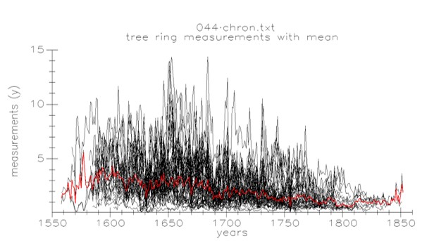
Kisatchie Hills Wilderness (KSH), Period:1598 to 1891 Boyds Creek (BYD), Period:1636 to 1994 Rough Hollow, NPS (RGH), Period:1610 to 2014 Missouri Ozark Forest Ecosystem Project (MOFEP) Site 5 (MF5), Period:1609 to 1910 Lost Creek (LST), Period:1651 to 2005 Breakfast Roll (BKF), Period:1635 to 2005 Park Hill Area 3 (PK3), Period:1605 to 2016 Bracebridge (BRB), Period:1755 to 2014 Lazy S-B Ranch (LSB), Period:1670 to 1999 Wipple Lake (WIP), Period:1712 to 2005 Bay Hollow, NPS (BAY), Period:1715 to 1960 Denning Hollow Glade (DHG), Period:1641 to 1993 Rymers Ranch, NPS (RYM), Period:1547 to 2013 Missouri Ozark Forest Ecosystem Project (MOFEP) Site 6 (MF6), Period:1653 to 2011 Niobrara River Breaks (NRB), Period:1707 to 2015 Burnt Mountain (BRT), Period:1585 to 1912 Park Hill Area 4 (PK4), Period:1480 to 2005 Jocko River (JKO), Period:1530 to 2011 Okmulgee State Wildlife Management Area (OGM), Period:1706 to 2004 West Udell Hills (WUH), Period:1740 to 1923 Cedar Hollow, Nickel Preserve (CDH), Period:1756 to 1934 Dog Hollow, Nickel Preserve (DOG), Period:1664 to 1852 Shannondale State Forest (SDF), Period:1643 to 2014 White Oak Mountain (WOM), Period:1687 to 2010 Niobrara Valley Preserve (NVP), Period:1727 to 2010 Baxter Mountain (BXT), Period:1698 to 1888 Pine Lake (PLK), Period:1715 to 1913 Papineau Lake (PPU), Period:1631 to 2004 Purtis Creek State Park (PRC), Period:1587 to 2002 Eleven Point River region (EPT), Period:1496 to 1980 Deer Run State Forest (DRN), Period:1700 to 1940 Shawnee State Forest (SHW), Period:1619 to 2013 Welch Spring, NPS (WLH), Period:1685 to 1905 Sand Creek (SND), Period:1520 to 1916 Cass Lake (CAS), Period:1656 to 1945 Potter Mountain (PMT), Period:1577 to 2015 Seguin Falls (SGN), Period:1650 to 2005 Rowland Creek Headwaters (RCH), Period:1680 to 2000 Gladden Creek, Cedar Grove State Forest (GLD), Period:1491 to 2017 Hartshorn SF (HRH), Period:1634 to 1875 Spring Valley, Alley Spring S.F. (SPV), Period:1614 to 2015 Caney Mountain Wildlife Refuge (CMW), Period:1593 to 2004 Soda Creek (SOD), Period:1558 to 1919 Fraver old-growth site (FAV), Period:1584 to 2010 Rush Lake (RSH), Period:1681 to 2005 Nye Cabin (NYE), Period:1403 to 2005 Reference Site (REF), Period:1670 to 2000 Mill Creek (MCR), Period:1632 to 1869 Johns Mountain Wildlife Management Area (JMT), Period:1656 to 1861 Stegall Mountain, Peck Ranch (STG), Period:1650 to 2010 Savage Gulf State Natural Area (SAV), Period:1630 to 2016 Upper West Ash Creek (UWA), Period:1628 to 2017 Grindle Lake (GRL), Period:1617 to 1921 Slate Run (SLR), Period:1674 to 1907 Rudolf Bennitt (RUD), Period:1586 to 1804 Raing Guage Flat, Wichita Mountains (RGF), Period:1616 to 2003 Mill Mountain, Rocky Creek State Forest (MMT), Period:1605 to 2018 Jerktail Mountain (JRT), Period:1705 to 2002 Tell Hollow, Nickel Preserve (TEL), Period:1701 to 2017 Angel Hollow (ANG), Period:1637 to 2010 West Ash Creek (WAC), Period:1642 to 2017 Homer Mountain (HOM), Period:1561 to 2005 Upper Dry Run (UDR), Period:1684 to 1988 Loess Hills (LOH), Period:1636 to 1955 Saltwell Hollow (SLT), Period:1721 to 2002 MOFEP Site 2 (MO2), Period:1714 to 1993 Mahans Creek, Rocky Creek State Forest (MAH), Period:1585 to 1907 Tully Hollow, Nickel Preserve (TLY), Period:1724 to 1901 2010 NADEF, Site 395 (395), Period:1490 to 2005 State Game Land 53 (53), Period:1574 to 1864 Ives Run Area 2 (IV2), Period:1687 to 1983 Waubee Lake (WBE), Period:1727 to 2003 White Ranch SF (WRS), Period:1776 to 2005 Tallgrass Prairie Preserve (TPP), Period:1742 to 2004 MOFEP Site 3 (MO3), Period:1626 to 1993 Medley Hollow, Mark Twain National Forest (MDL), Period:1594 to 1888 Alley Spring, NPS (ALY), Period:1579 to 2016 Ichauway, Baker Woods (ICH), Period:1547 to 2005 State Game Land 81 (81), Period:1602 to 2017 Ives Run Area 3 (IV3), Period:1659 to 2013 Cranberry Bog (CRN), Period:1783 to 2003 Bastrop State Park (BST), Period:1629 to 2005 Tishomingo National Wildlife Refuge (TSH), Period:1595 to 1905 MOFEP Site 7 (MO7), Period:1671 to 1935 Mill Hollow, Pioneer Forest (MLH), Period:1656 to 1993 Chigger Road (CHR), Period:1636 to 2016 Brymer Mountain (BRY), Period:1726 to 2005 State Game Land 84 (84), Period:1664 to 2017 Ives Lake (IVL), Period:1700 to 1858 State Game Land 88 (88), Period:1746 to 2009 Cache Creek, Wichita Mountains (CCH), Period:1729 to 2005 Boone Creek Barrens (BCR), Period:1671 to 2004 Turkey Mountain (TKY), Period:1661 to 1996 MOFEP Site 8 (NOR), Period:1617 to 1921 Falling Water (FLW), Period:1608 to 1950 Choccolocco Mountain (CHO), Period:1312 to 2002 Basin Lake, Algonquin Park (BSL), Period:1687 to 1941 Ives Run (IVR), Period:1690 to 2008 State Game Land 100 (100), Period:1545 to 1921 Deep Fork National Wildlife Refuge (DPF), Period:1507 to 2005 Huckleberry Creek Barrens (HCK), Period:1671 to 1991 Baptist Access, NPS (BAP), Period:1770 to 1967 Panther Cave Hollow, MOFEP Site 9 (PCH), Period:1604 to 1996 Gee Creek (GEE), Period:1690 to 1998 Cumberland Island (CUI), Period:1639 to 1982 Costello Creek, Algonquin Park (COS), Period:1770 to 2002 Long Branch Hill (LBH), Period:1604 to 1996 State Game Land 107 (107), Period:1439 to 1976 Hagerman National Wildlife Refuge (HAG), Period:1730 to 2016 French Lake, Wichita Mountains (WCH), Period:1652 to 1915 Big Creek, Mark Twain National Forest (BIG), Period:1495 to 1989 Pine Camp, Land Between the Lakes (PCP), Period:1791 to 2005 Granny Gap (GGP), Period:1773 to 1913 Morrow Ranch (MOR), Period:1708 to 2005 State Game Land 37 (37), Period:1601 to 2011 Moqua Barrens (MOQ), Period:1791 to 2005 Shriner Mountain (SHR), Period:1822 to 2014 Hollis Canyon, Wichita Mountains (HOL), Period:1578 to 2009 Huron Manistee Guyette site (DDG), Period:1680 to 1999 Bloom Creek State Forest (BLM), Period:1600 to 1940 Pumpkin Hollow, Nickel Preserve (PMK), Period:1590 to 2015 Granite Mountain (GMT), Period:1643 to 1905 Capulin Volcano NM (CAP), Period:1703 to 2016 Airport Road (AIR), Period:1688 to 2005 Norway Beach (NWB), Period:1611 to 2016 State Game Land 170 (170), Period:1780 to 1922 Keystone Ancient Forest Preserve (KEY), Period:1741 to 1972 Turkey Tail Lake (TTL), Period:1524 to 2010 Deep Gulch, Theodore Roosevelt National Park (TRS), Period:1716 to 1960 Barn Hollow Natural Area (BRN), Period:1513 to 1967 Paint Rock State Forest (PTR), Period:1563 to 2013 Gobblers Knob (GOB), Period:1536 to 1900 Carter Canyon Ranch (CCR), Period:1685 to 1903 Big Hill Area 1 (BH1), Period:1701 to 2004 Park Hill Area 1 (PK1), Period:1618 to 2016 Big Spring Pines (BPA), Period:1628 to 1927 Land Between the Lakes, Jenny Ridge (LBL), Period:1655 to 1999 Wolf Lake (WFL), Period:1567 to 2010 Ava Glade (AVA), Period:1737 to 1771 MOFEP Site 1 (BSS), Period:1665 to 1856 Pultite, NPS (PUL), Period:1628 to 2014 Hatton Ridge (HTR), Period:1550 to 1940 Devils Tower National Monument (DET), Period:1595 to 1892 Big Hill Area 2 (BH2), Period:1758 to 2005 Park Hill Area 2 (PK2), Period:1660 to 2017 State Game Land 44 (44), Period:1556 to 2011 Lemm Swamp (LEM), Period:1634 to 1973 Lake Winnibigoshish (WIN), Period:1638 to 1871
Tree Ring - Data Set Requested
Eleven Point River region (EPT), Period:1496 to 1980 Ichauway, Baker Woods (ICH), Period:1491 to 2005 State Game Land 84 (84), Period:1664 to 2017 Moqua Barrens (MOQ), Period:1791 to 2005 Shriner Mountain (SHR), Period:1822 to 2014 Lazy S-B Ranch (LSB), Period:1670 to 1999 West Udell Hills (WUH), Period:1740 to 1923 Gladden Creek, Cedar Grove State Forest (GLD), Period:1491 to 2017 Brymer Mountain (BRY), Period:1726 to 2005 State Game Land 37 (37), Period:1601 to 2011 Norway Beach (NWB), Period:1611 to 2016 State Game Land 170 (170), Period:1780 to 1922 Okmulgee State Wildlife Management Area (OGM), Period:1706 to 2004 American Long Oak Chronology, Period:912-2004 Johns Mountain Wildlife Management Area (JMT), Period:1656 to 1861 Choccolocco Mountain (CHO), Period:1312 to 2002 Airport Road (AIR), Period:1688 to 2005 Park Hill Area 1 (PK1), Period:1618 to 2016 Big Spring Pines (BPA), Period:1628 to 1927 Purtis Creek State Park (PRC), Period:1587 to 2002 Wichita Mountains Juniper, Period: 1227-2011 Jerktail Mountain (JRT), Period:1705 to 2002 Morrow Ranch (MOR), Period:1708 to 2005 Big Hill Area 1 (BH1), Period:1701 to 2004 Park Hill Area 2 (PK2), Period:1660 to 2017 State Game Land 44 (44), Period:1556 to 2011 Rowland Creek Headwaters (RCH), Period:1680 to 2000 Mahans Creek, Rocky Creek State Forest (MAH), Period:1585 to 1907 Capulin Volcano NM (CAP), Period:1703 to 2016 Big Hill Area 2 (BH2), Period:1758 to 2005 Park Hill Area 3 (PK3), Period:1605 to 2016 Nye Cabin (NYE), Period:1403 to 2005 Reference Site (REF), Period:1670 to 2000 Pine Camp, Land Between the Lakes (PCP), Period:1791 to 2005 Carter Canyon Ranch (CCR), Period:1685 to 1903 Burnt Mountain (BRT), Period:1585 to 1912 Park Hill Area 4 (PK4), Period:1480 to 2005 Rudolf Bennitt (RUD), Period:1586 to 1804 Raing Guage Flat, Wichita Mountains (RGF), Period:1616 to 2003 Shawnee State Forest (SHW), Period:1619 to 2013 Devils Tower National Monument (DET), Period:1595 to 1892 Baxter Mountain (BXT), Period:1698 to 1888 Pine Lake (PLK), Period:1715 to 1913 Loess Hills (LOH), Period:1636 to 1955 Saltwell Hollow (SLT), Period:1721 to 2002 Tell Hollow, Nickel Preserve (TEL), Period:1701 to 2017 Lost Creek (LST), Period:1651 to 2005 Cass Lake (CAS), Period:1656 to 1945 Potter Mountain (PMT), Period:1577 to 2015 White Ranch SF (WRS), Period:1776 to 2005 Tishomingo National Wildlife Refuge (TSH), Period:1595 to 1905 Tully Hollow, Nickel Preserve (TLY), Period:1724 to 1901 Niobrara River Breaks (NRB), Period:1707 to 2015 Fraver old-growth site (FAV), Period:1584 to 2010 Rush Lake (RSH), Period:1681 to 2005 Bastrop State Park (BST), Period:1629 to 2005 Boone Creek Barrens (BCR), Period:1671 to 2004 Alley Spring, NPS (ALY), Period:1579 to 2016 Niobrara Valley Preserve (NVP), Period:1727 to 2010 Grindle Lake (GRL), Period:1617 to 1921 Slate Run (SLR), Period:1674 to 1907 Cache Creek, Wichita Mountains (CCH), Period:1729 to 2005 Huckleberry Creek Barrens (HCK), Period:1671 to 1991 Falling Water (FLW), Period:1608 to 1950 Sand Creek (SND), Period:1520 to 1916 Homer Mountain (HOM), Period:1561 to 2005 Upper Dry Run (UDR), Period:1684 to 1988 Deep Fork National Wildlife Refuge (DPF), Period:1507 to 2005 French Lake, Wichita Mountains (WCH), Period:1652 to 1915 Gee Creek (GEE), Period:1690 to 1998 Soda Creek (SOD), Period:1558 to 1919 Ives Run Area 2 (IV2), Period:1687 to 1983 Waubee Lake (WBE), Period:1727 to 2003 Hagerman National Wildlife Refuge (HAG), Period:1730 to 2016 Huron Manistee Guyette site (DDG), Period:1680 to 1999 Gobblers Knob (GOB), Period:1536 to 1900 Upper West Ash Creek (UWA), Period:1628 to 2017 Ives Run Area 3 (IV3), Period:1659 to 2013 Cranberry Bog (CRN), Period:1783 to 2003 Hollis Canyon, Wichita Mountains (HOL), Period:1578 to 2009 Turkey Tail Lake (TTL), Period:1524 to 2010 Hatton Ridge (HTN), Period:1550 to 1940 West Ash Creek (WAC), Period:1642 to 2017 Ives Lake (IVL), Period:1700 to 1858 State Game Land 88 (88), Period:1746 to 2009 Keystone Ancient Forest Preserve (KEY), Period:1741 to 1972 Wolf Lake (WFL), Period:1567 to 2010 Deep Gulch, Theodore Roosevelt National Park (TRS), Period:1716 to 1960 Savage Gulf State Natural Area (SAV), Period:1630 to 2016 State Game Land 53 (53), Period:1574 to 1864 Ives Run (IVR), Period:1690 to 2008 State Game Land 100 (100), Period:1545 to 1921 Land Between the Lakes, Jenny Ridge (LBL), Period:1655 to 1999 Lake Winnibigoshish (WIN), Period:1638 to 1871 Kisatchie Hills Wilderness (KSH), Period:1598 to 1891 Angel Hollow (ANG), Period:1637 to 2010 State Game Land 81 (81), Period:1602 to 2017 Long Branch Hill (LBH), Period:1604 to 1996 State Game Land 107 (107), Period:1439 to 1976 Lemm Swamp (LEM), Period:1634 to 1973 Wipple Lake (WIP), Period:1712 to 2005
Climate Reconstruction - Data Set Requested
Summer season drought, Period 992-2004 Palmer Drought Z-Index, Period: 1594-2017
Other - Data Set Requested
First Name
*
Last Name
*
Affiliation
*
Email
*
Brief Explanation of the project for which these data will be used...
If you are human, leave this field blank.